
Most Downloaded Plugins
List of approved plugins sorted by the number of downloads.
2176 records found

Route Sqlite
This plugin creates route geometries to sqlite table containing from/to points using ORS
2019-03-20T13:59:44.662875+00:00
Demands in distribution networks
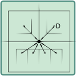
Algorithms for computing demand at nodes of the distribution network
2019-02-15T14:54:09.744110+00:00

MOS-Adeupa-CE
Allows user to generate a landuse with cross-referring data from different origins.
2019-09-16T06:32:34.486080+00:00

Lidar Campania
Import lidar data (1x1) from the Campania region (Italy). Data are added directly from the website http://sit.cittametropolitana.na.it/
2021-11-30T14:06:11.558576+00:00

NDFF Connector Plugin
This connector uses the NDFF-Connector library to create all needed configuration and settings to connect to the NDFF api, to …
2024-10-07T06:24:07.321423+00:00

Roll
Design and analysis of 3D seismic survey geometries
2024-11-02T11:52:24.522569+00:00

HOT Templates and Symbology Manager
QGIS plugin for managing HOT map templates and symbology
2023-05-17T11:24:06.573475+00:00

Inclinometry calculator
Plugin for inclinometry processing
2021-11-12T20:35:46.524490+00:00

JagdKataster
This plugin creates german hunt cadastres from German cadastre data (therefore not localized)
2020-08-23T11:56:19.208323+00:00
Plot grid tool
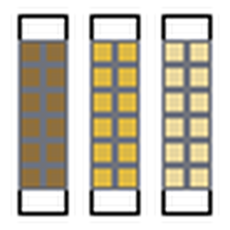
This plugin create a grid file from a plot boundary file
2023-02-11T19:53:25.903820+00:00

DiscordRPC Plugin for QGIS
QGIS plugin that enables displaying a Rich Presence in Discord
2024-02-15T23:53:07.912343+00:00

Topomine
Topomime Plugin
2015-02-09T08:41:11.478128+00:00

Moisture and Water Index
Este complemento calcula el índice NDWI con las imágenes del Landsat 8.
2023-10-27T21:49:35.574493+00:00

HyShell
Convert the Python console into a Hy Shell. Hy is a LISP build on Python AST.
2015-02-25T06:46:48.836245+00:00

Transperator
Make black invisible in all raster layers
2015-11-18T08:25:30.738312+00:00

Modzy
This plugin provides seamless access to Modzy's ML, DL and AI models. Please be sure to install the Modzy SDK …
2022-03-01T19:22:38.936496+00:00

Layer Grid View
The Layer Grid Plugin provides an intuitive dockable widget that presents a grid of map canvases.
2023-09-24T00:47:23.372757+00:00

WiscSIMS Tool
Useful QGIS tools for WiscSIMS sessions
2022-10-15T21:52:53.055782+00:00

Altibase QGIS Plugin
QGIS plugin to transfer of spatial data between QGIS and Altibase servers.
2020-07-30T02:29:07.911183+00:00
BHCgeo
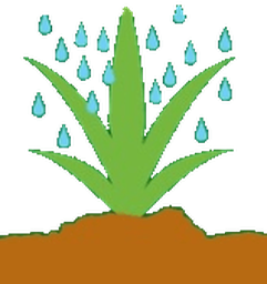
Calculates the Climatic Water Balance in each pixel
2023-04-12T13:34:57.822083+00:00
| Name | Author | Latest Version | Created On | Stars (votes) | ||||
|---|---|---|---|---|---|---|---|---|
|
|
Route Sqlite | 2,832 | Mátyás Gede | 2019-03-20T13:59:44.662875+00:00 | 2019-03-20T13:59:43.610896+00:00 |
(1)
|
— | 0.5 |
|
|
Demands in distribution networks | 2,827 | Eder Nilson, Julian Cardona | 2019-02-15T14:54:09.744110+00:00 | 2019-02-15T14:54:09.318492+00:00 |
(17)
|
0.3 | — |
|
|
MOS-Adeupa-CE | 2,822 | Corentin Falcone (SIRS) | 2019-09-16T06:32:34.486080+00:00 | 2019-07-01T12:29:27.622661+00:00 |
(5)
|
1.0.1 | — |
|
|
Lidar Campania | 2,819 | Enzo Cocca | 2021-11-30T14:06:11.558576+00:00 | 2021-11-29T19:07:02.910488+00:00 |
(0)
|
0.4 | — |
|
|
NDFF Connector Plugin | 2,819 | BIJ12-NDFF | 2024-10-07T06:24:07.321423+00:00 | 2022-10-03T18:45:24.929492+00:00 |
(0)
|
0.9.0 | — |
|
|
Roll | 2,813 | Duijndam.Dev | 2024-11-02T11:52:24.522569+00:00 | 2024-03-13T14:57:47.103591+00:00 |
(7)
|
0.3.8 | 0.3.2 |
|
|
HOT Templates and Symbology Manager | 2,811 | Kartoza | 2023-05-17T11:24:06.573475+00:00 | 2023-05-17T11:24:06.120671+00:00 |
(2)
|
1.0.2 | — |
|
|
Inclinometry calculator | 2,804 | Michael Chernov | 2021-11-12T20:35:46.524490+00:00 | 2021-02-15T11:42:32.686365+00:00 |
(1)
|
1.3 | 0.2 |
|
|
JagdKataster | 2,801 | Simon Hodrus | 2020-08-23T11:56:19.208323+00:00 | 2020-04-21T14:20:02.455967+00:00 |
(5)
|
0.1.2 | — |
|
|
Plot grid tool | 2,800 | Jinha Jung | 2023-02-11T19:53:25.903820+00:00 | 2023-02-08T14:11:37.358711+00:00 |
(5)
|
0.2 | — |
|
|
DiscordRPC Plugin for QGIS | 2,798 | Ahhj93 | 2024-02-15T23:53:07.912343+00:00 | 2023-05-29T09:04:59.853504+00:00 |
(23)
|
5.1 | 2.0 |
|
|
Topomine | 2,793 | Éric Mermet (Éhess) | 2015-02-09T08:41:11.478128+00:00 | 2015-02-05T11:26:05.725806+00:00 |
(3)
|
— | 0.3 |
|
|
Moisture and Water Index | 2,764 | Francisca Ruiz-Tagle Santander y Keyla Alencar da Silva UTEM UNR CONICET | 2023-10-27T21:49:35.574493+00:00 | 2022-12-19T22:27:27.105885+00:00 |
(1)
|
1.5.2 | — |
|
|
HyShell | 2,757 | Nathan Woodrow | 2015-02-25T06:46:48.836245+00:00 | 2015-02-24T23:41:41.390830+00:00 |
(0)
|
— | 1.2 |
|
|
Transperator | 2,737 | Ronen Abravanel | 2015-11-18T08:25:30.738312+00:00 | 2015-11-17T10:26:34.023312+00:00 |
(0)
|
— | 0.2 |
|
|
Modzy | 2,726 | Modzy | 2022-03-01T19:22:38.936496+00:00 | 2022-02-22T23:41:37.775225+00:00 |
(6)
|
0.21 | 0.2 |
|
|
Layer Grid View | 2,723 | Tharles de Sousa Andrade | 2023-09-24T00:47:23.372757+00:00 | 2023-09-24T00:47:23.257574+00:00 |
(4)
|
0.1 | — |
|
|
WiscSIMS Tool | 2,717 | WiscSIMS (Kouki Kitajima) | 2022-10-15T21:52:53.055782+00:00 | 2020-08-21T16:09:11.438021+00:00 |
(0)
|
3.2.4 | — |
|
|
Altibase QGIS Plugin | 2,714 | Altibase Corp. | 2020-07-30T02:29:07.911183+00:00 | 2020-07-29T23:11:30.732702+00:00 |
(3)
|
— | 0.1 |
|
|
BHCgeo | 2,706 | Carvalho Neto, R.M. - UFSM; Cruz, J.C. - UFSM; Cruz, R.C. - UNIPAMPA | 2023-04-12T13:34:57.822083+00:00 | 2020-05-04T19:40:13.725081+00:00 |
(8)
|
— | 0.3 |


