
Most Voted Plugins
List of approved plugins sorted by the number of votes.
2210 records found

Mapflow
Extract real-world objects from satellite imagery with Mapflow by Geoalert. Mapflow provides AI mapping pipelines for building footprints, roads, fields, …
2024-12-21T03:22:18.634285+00:00

PDOK services plugin
Plugin to easily load the available Dutch PDOK (Publieke Dienstverlening Op de Kaart) services. Currently only in Dutch.
2024-07-19T15:19:01.570373+00:00

Color Ramp Manager
plugin to manage and download color ramp definitions
2013-06-13T21:53:33.108951+00:00

Vector Bender
Does to vectors what georefencers does to raster. This feature is also known as "rubber sheeting".
2019-12-03T12:19:59.975611+00:00

Terminus
Image Segmentation
2022-03-20T11:56:50.632609+00:00
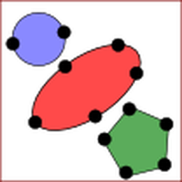
ArcheoCAD
Generates a vectorial layer of Polygons, Rectangles, Circles and Ellipses using vertices.
2021-11-26T14:40:59.652228+00:00

Fast Density Analysis
A fast kernel density visualization plugin for geospatial analytics
2023-07-12T07:55:31.779720+00:00

QGIS GML Application Schema Toolbox
Consumption and use of GML complex features like INSPIRE harmonised data (vector), GeoSciML within QGIS
2022-09-23T03:54:28.374019+00:00

Load QSS - UI themes
Configure look and feel for Qgis
2017-10-29T10:05:39.948610+00:00

Quick Finder
Quick Finder offers a single place to perform searches on project layers and online remote services
2017-10-11T06:58:58.211999+00:00

LRS
Linear reference system builder and editor
2022-12-19T09:56:13.293449+00:00

QEPANET
This plugin links QGIS and EPANET. It provides: a set of dedicated editing tools to build a correct EPANET network, …
2024-10-10T06:32:30.857776+00:00

Search Layers
Enhanced textual searching on all QGIS layers and fields.
2024-09-13T18:42:59.757933+00:00
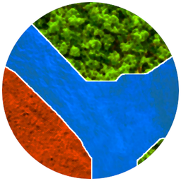
Deepness: Deep Neural Remote Sensing
Inference of deep neural network models (ONNX) for segmentation, detection and regression
2024-12-10T10:38:22.549072+00:00

Geoscience
Tools for Geoscience & Exploration
2024-06-27T13:12:49.540390+00:00

Mergin Maps
Handle Mergin Maps projects
2024-10-03T12:10:03.171117+00:00

norGIS ALKIS-Einbindung
This plugin is dealing with German cadastre data (therefore not localized)
2024-05-28T15:11:50.364592+00:00

QNEAT3
QNEAT3 - QGIS Network Analysis Toolbox 3
2023-06-17T15:28:26.833309+00:00

Raster Interpolation
Raster Interpolation browses a vector layer of points, interpolates at their position the value of a raster layer and save …
2013-10-04T09:50:18.438596+00:00

TileLayer Plugin
TileLayerPlugin is a plugin to add tiled maps on your map canvas.
2016-07-14T02:35:59.202062+00:00
| Name | Author | Latest Version | Created On | Stars (votes) | ||||
|---|---|---|---|---|---|---|---|---|
|
|
Mapflow | 120,689 | Geoalert | 2024-12-21T03:22:18.634285+00:00 | 2021-07-09T15:15:42.595345+00:00 |
(100)
|
3.0.0 | — |
|
|
PDOK services plugin | 266,353 | Richard Duivenvoorde | 2024-07-19T15:19:01.570373+00:00 | 2012-10-20T19:17:35.065378+00:00 |
(100)
|
5.1.1 | — |
|
|
Color Ramp Manager | 30,371 | Etienne Tourigny | 2013-06-13T21:53:33.108951+00:00 | 2012-08-06T23:29:03.773725+00:00 |
(99)
|
— | 0.3.0 |
|
|
Vector Bender | 98,848 | Olivier Dalang | 2019-12-03T12:19:59.975611+00:00 | 2014-05-23T00:45:30.818225+00:00 |
(99)
|
0.2.1 | 0.1.1 |
|
|
Terminus | 4,123 | Ioannis Kotaridis and Maria Lazaridou | 2022-03-20T11:56:50.632609+00:00 | 2020-10-26T21:43:53.347557+00:00 |
(99)
|
1.0.2 | 0.1 |
|
|
ArcheoCAD | 126,357 | Nariman Hatami - INRAP | 2021-11-26T14:40:59.652228+00:00 | 2014-08-13T08:34:44.262815+00:00 |
(97)
|
3.2.2 | — |
|
|
Fast Density Analysis | 11,269 | LibKDV Group | 2023-07-12T07:55:31.779720+00:00 | 2023-06-27T18:24:39.182002+00:00 |
(95)
|
1.6 | — |
|
|
QGIS GML Application Schema Toolbox | 50,511 | BRGM, Oslandia, Copernicus, Camptocamp, Spatialys, titellus | 2022-09-23T03:54:28.374019+00:00 | 2016-06-27T14:17:30.186023+00:00 |
(94)
|
1.3.1 | 1.4.0-beta6 |
|
|
Load QSS - UI themes | 38,249 | Francisco Raga | 2017-10-29T10:05:39.948610+00:00 | 2015-04-29T10:31:15.377978+00:00 |
(94)
|
1.4.2 | 1.3 |
|
|
Quick Finder | 142,825 | Denis Rouzaud, Arnaud Morvan | 2017-10-11T06:58:58.211999+00:00 | 2012-04-12T14:51:18.769439+00:00 |
(93)
|
3.3.3 | — |
|
|
LRS | 66,896 | Radim Blazek, Simon South, Christophe Damour | 2022-12-19T09:56:13.293449+00:00 | 2014-02-05T10:40:03.342384+00:00 |
(93)
|
1.2.3 | — |
|
|
QEPANET | 61,033 | UNIBZ - UNITN | 2024-10-10T06:32:30.857776+00:00 | 2017-08-10T13:51:50.918866+00:00 |
(93)
|
2.5.6 | — |
|
|
Search Layers | 124,625 | Calvin Hamilton | 2024-09-13T18:42:59.757933+00:00 | 2017-10-20T20:06:11.291030+00:00 |
(93)
|
3.1.1 | — |
|
|
Deepness: Deep Neural Remote Sensing | 30,598 | PUT Vision | 2024-12-10T10:38:22.549072+00:00 | 2022-10-20T11:38:13.982136+00:00 |
(93)
|
0.6.5 | 0.3.0 |
|
|
Geoscience | 84,724 | Roland Hill | 2024-06-27T13:12:49.540390+00:00 | 2018-09-18T21:47:14.396817+00:00 |
(92)
|
1.15 | 0.62 |
|
|
Mergin Maps | 137,605 | Lutra Consulting | 2024-10-03T12:10:03.171117+00:00 | 2019-04-18T14:17:19.422429+00:00 |
(91)
|
2024.2.1 | — |
|
|
norGIS ALKIS-Einbindung | 92,288 | Jürgen E. Fischer | 2024-05-28T15:11:50.364592+00:00 | 2014-08-01T12:09:28.233250+00:00 |
(91)
|
2.0.56 | 2.0.20 |
|
|
QNEAT3 | 131,683 | Clemens Raffler | 2023-06-17T15:28:26.833309+00:00 | 2018-06-04T21:43:53.595047+00:00 |
(90)
|
1.0.5 | — |
|
|
Raster Interpolation | 104,987 | Denis Rouzaud | 2013-10-04T09:50:18.438596+00:00 | 2013-05-08T09:15:11.325181+00:00 |
(89)
|
1.3.5 | — |
|
|
TileLayer Plugin | 129,820 | Minoru Akagi | 2016-07-14T02:35:59.202062+00:00 | 2013-12-01T08:16:05.072033+00:00 |
(89)
|
0.80 | — |


